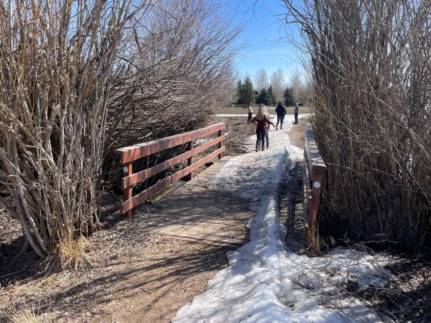
Willow Creek runs from Canyons Village into the central neighborhoods of the Snyderville Basin and the wetlands of the Swaner Preserve.
One street beside the creek flooded April 17 and residents wonder what should be done to protect property in the wetlands.
Almost 30 homeowners, homeowners’ association representatives and county and state officials gathered Friday morning at the East Meadows trailhead in Silver Springs, which was still partially frozen over.
Former Park City Councilmember and Summit County Commissioner Bob Richer, who lives in Ranch Place, set up the meeting. He began by thanking different people for their time and attention to homeowners’ concerns about Willow Creek.
One of those people was Silver Springs resident Matt Lindon, a hydrologist. He had some numbers he said his neighbors should be aware of.
The current flow in Willow Creek is about 20 to 30 cubic feet per second.
That’s the same amount of water that was flowing in the creek earlier this month when it flooded, after debris clogged the stream.
One cubic foot is about 7.5 gallons.
Lindon said the creek could be carrying 40 cubic feet per second by Monday.
The creek is five feet wide and two feet deep, at 10 square feet total. So, flowing at four feet per second, that's 40 cubic feet per second. That's 300 gallons of water, weighing about 2,500 pounds, per second. Visually speaking, that is equal to one above-ground swimming pool or one Prius, per second.
That flow needs to be mitigated, but it’s complicated. That’s because Willow Creek runs through land owned by different individuals, HOAs and the Snyderville Basin Recreation District.
Richer appealed to residents’ goodwill and the desire to do their part to keep their section of the stream clean. He called that the "carrot."
“The carrot is please help your neighbors,” Richer said. “Please help your neighbors. There can be tens of thousands of dollars worth—hundreds of thousands of dollars worth—of damage.”
On a tour of the area last week, Summit County Councilmember Chris Robinson identified about a dozen private bridges that could be an issue when water levels rise.
Lindon said bridges should be three to four feet from the creek bed and 10 feet wide in order to accommodate the 100-year flood water and debris.
That’s the Army Corps of Engineers’ standard: prepare for a once-in-a-century water level. Preparing for anything rarer than that would be overkill, but it’s better than under-preparing. In Willow Creek, Lindon says the 100-year flood is 87 cubic feet per second. That's more than double what is predicted by Monday.
Bridges should also be firmly secured to the river bank. High water could dislodge them and turn them into dams. Many of these bridges are no more than wooden planks.
Richer said those planks should be removed, but only temporarily while the snow melts.
“Nobody's pointing fingers and saying you're a bad person because you put the bridge out there, Matt [Lindon] did it too,” he said. “But these are extraordinary circumstances.”

But there is a possible “stick.” Most of Willow Creek’s planks were likely placed without formal building permits. So if one person’s bridge becomes a dam and floods another person’s house, they could be held liable.
Robinson indicated that the carrot of helping neighbors downstream is preferable to exploring the ill-defined legal consequences.
“I do not think we ought to turn this crisis into a civil war among bridge owners,” he said.
No one at Friday’s meeting had a firm answer about who’s legally responsible for Willow Creek overall. County officials stress they can’t and won’t go onto private property to control the creek there.
So it has been and will be a patchwork effort of the different landowners around the creek.
To help it flow, Summit County Public Works and Basin Rec have cleared debris and culverts on the land they have legal access to.
The Silver Springs and Ranch Place HOAs have hired Greenleaf, a Park City-based landscaper, to clean up the creek on their land.

If there is a need for emergency work, Wendy Fisher from Utah Open Lands said local government authorities have the go-ahead. If livelihoods are threatened, state and federal agencies allow local authorities to work on 100-foot long sections of the creek.
“Their concern is, at a certain point, you take out too much vegetation and you destabilize the bank. And that creates even more problems,” Fisher said.
Finally, there is one part of the creek no one knows if anybody owns. It’s called the South Headgate, a rusty bit of metal near Ptarmigan Court which can theoretically be opened to dampen the downstream flow.
The people present at Friday’s meeting resolved to try to figure out who is allowed to operate it, but it remains an open question right now.
HOA representatives were able to coordinate with Fisher, the state representative at the meeting, and Greenleaf Vice President Robyn Bailey.
The HOAs will pass along a map Councilmember Robinson created of some of the problem areas to make sure the state will authorize emergency work in the event of a flood.
Friday’s meeting lasted a little over an hour, after which Richer announced a group was going to walk-through the Willow Creek area.


